THE MAJOR PORT AREAS OF SAINT-MALO & CANCALE
THE PORT OF SAINT-MALO IS DIVIDED INTO 2 LARGE SEPARATE AREAS
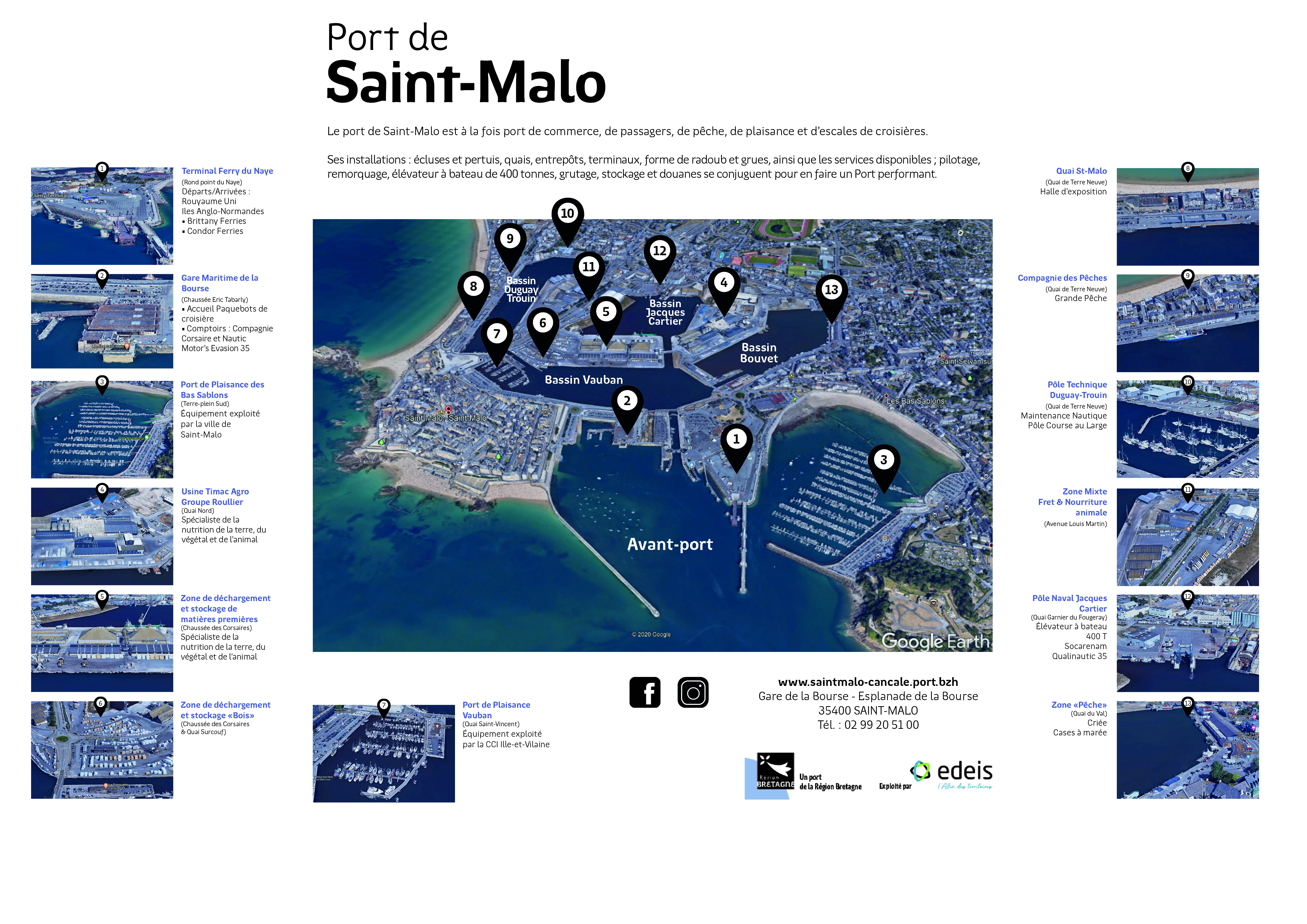
THE PORT OF SAINT-MALO IS DIVIDED INTO 2 LARGE SEPARATE AREAS
The outer port: area under the influence of the tide which hosts the ferry traffic with England and the Channel Islands, the big cruise ships and the marina of Bas-Sablons
The inland port with 4 floating basins : Vauban, Duguay-Trouin, Bouvet and Jacques Cartier. They accommodate the conventional cargo, the shipyards, the nautical maintenance, the fishing activity and the sailing vessels.
Access to the inner basins is through the Naye Lock which can accommodate vessels up to 150 m in length and 21 m in width with a draught of 9.00 m.
13 identified areas:
- Area 1: Le Naye ferry terminal
- Area 2: La Bourse cruise terminal
- Area 3: Marina of Les Bas Sablons
- Area 4: industrial site of Timac Agro - Groupe Roullier
- Area 5: Raw material unloading and storage area - Chaussée des Corsaires
- Area 6: Wood unloading and storage area - Chaussée des Corsaires and Quai Surcouf
- Area 7: Marina Vauban
- Area 8: Exhibition hall Le Quai St-Malo
- Area 9: Compagnie des Pêches (industrial fishing company)
- • Area 10: Pôle Technique Duguay-Trouin – Nautic maintenance and ocean racing activities
- Area 11: Mixed area Avenue Louis Martin – Freight and animal feed
- Area 12: Pôle Naval Jacques Cartier - Quai Garnier du Fougeray - travelift – Socarenam (shipyards)
- Area 13: Fishing port - Quai du Val – Fish market – Facilities for professional fishers and fishmongers